OilFieldH2O Platform

Analytics-ready data, mapping, and analysis

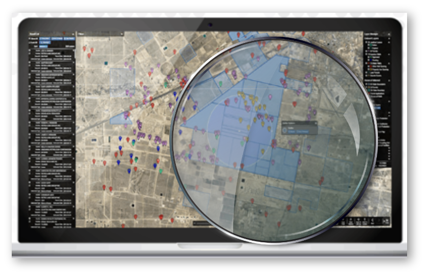
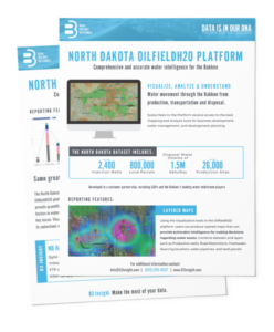
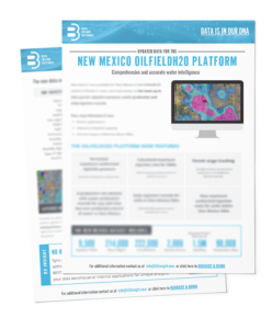
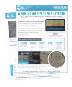
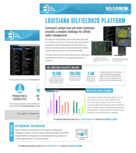
B3 Insight’s OilfieldH2O™ Platform is a powerful tool that unlocks the potential of data to provide valuable insights for water management by offering the best mapping and analysis tools for water assets, development trends, business activity, and ownership information.

Revolutionize Water-Related Decision-Making

Transform complex data into actionable information

Looking for a way to turn your oilfield water data from complex to compelling? Look no further than the B3 Insight OilfieldH2O™ Platform.

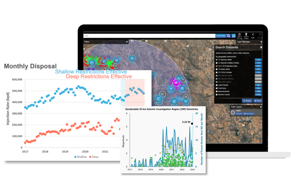
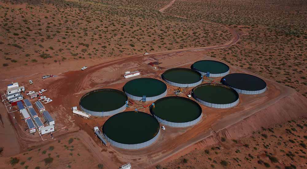
With extensive public and proprietary data, our platform offers features and workflows to help you achieve operational excellence, optimize water logistics, and even discover disposal and mergers and acquisitions trends. Plus, with our platform’s ability to identify new market opportunities, generate leads, and increase revenue, you’ll be raking in the cash while reducing your oilfield footprint.

Ready to dive into the deep end of oilfield water management? Download our OilfieldH2O™ Platform E-book now and make a splash with the power of data-driven insights!

OilfieldH2O™ Key Features and Workflows

Business Intelligence

graph_interface2

Risk Management

platform_graphic

Planning and Optimization

No matter if you’re managing a single well or thousands, the OilfieldH2O™ platform makes it easy to analyze multiple, large, and complex datasets at one time.

Don’t miss the boat–schedule a demo of the OilfieldH2O™ Platform today and discover how B3 Insight can help you navigate the waters with ease.

Platform Features

filter

Filter & Sort

B3 filters give you tools to pinpoint specific records in large search results. It’s the power of advanced database queries, with just the click of a mouse.

export-file

Export Data

You can find, evaluate and save your work in B3, but it doesn’t end there. Produce on-the-fly work product for clients. Projects, records, documents, and geographic information are all exportable in PDF, Excel, CSV, KMZ and shapefile formats.

search-interface-symbol

Smart Search

"Google-like" search functionality makes research easy, intelligent and efficient. Intuitive map element and spatial searches turn every component of your map into a powerful search tool to access diverse datasets.

import

Import Data

Import your own shapefiles into the OilfieldH20 Platform. B3 users can upload their own geospatial data and utilize it in B3’s platform, in conjunction with B3 data for better decision making.

address

Map Creator

Create, customize and export maps to share geospatial data from the B3 platform. Maps can be download as a PDF and shared with others in presentations, privately with specific individuals, or printed for reports and projects

folder

Save & Share Projects

Create customized, self-updating dashboards and visualizations through Saved Projects. Share “Projects” across users, empowering cross-department collaboration. Improve organizational collaboration, resulting in efficient problem solving and better project outcomes.

location-pin

Symbolization Tool & Heatmaps

Symbolize, manage and customize visualization of datasets. Specify symbology of datasets by defining rules that control representations and labels. Enhance productivity and insight by allowing you to apply representations and label expressions to feature layers.

analysis

Reporting & Analytics

Leverage beautiful charting and reporting tools to access time series and summaries of broad data.

B3 Insight provides customers with the best mapping and analysis tools for water assets, development trends, business activity, and ownership information. Learn more about our datasets by downloading their fact sheets:

OILFIELD H2O North Dakota

OILFIELDH20 New Mexico

OILFIELDH20 Wyoming

OILFIELDH20 Louisiana

Empowering Smart Water Management